
Punjab Flood Watch Today: Why Nearly 400 Sq Km Are Underwater
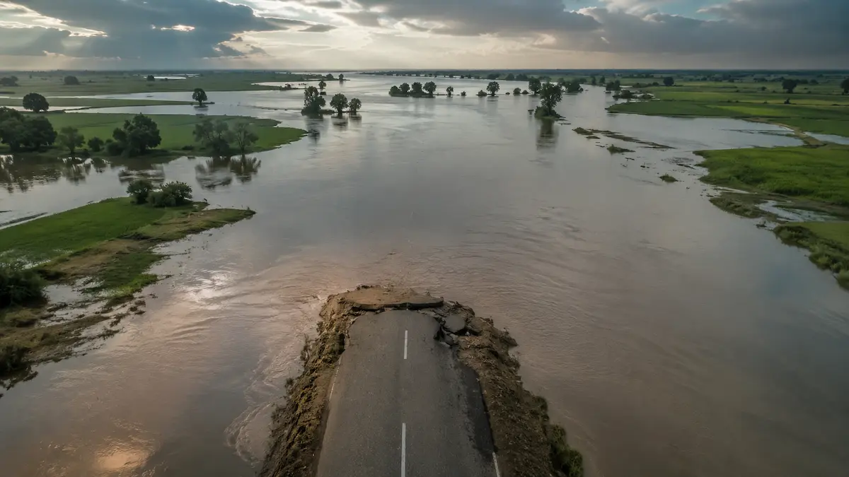
Large parts of Punjab remain under close watch as floodwater spreads across farmland, villages and roads. Officials confirm that close to 400 square kilometres have already gone underwater.
The Chenab and Ravi rivers continue to carry high volumes of water downstream. According to the Pakistan Meteorological Department, medium to high flood levels are expected to continue at several stations along both rivers.
Latest River Levels and Official Forecast
The Chenab River at Marala, Khanki and Qadirabad is expected to stay in the medium to high flood range. The Ravi River at Balloki and Sidhnai is also forecast to remain elevated as more water moves downstream.
One number stands out. Water reaching Balloki is far higher than what was recorded upstream at Shahdara, a sign that local drainage is adding pressure to the river system. Readers can compare this to the concerns raised in our earlier report on the Punjab flood alert and city risk this monsoon season.
| River Station | Latest Situation |
|---|---|
| Marala (Chenab) | Medium to high flood forecast |
| Khanki (Chenab) | Medium to high flood forecast |
| Qadirabad (Chenab) | Medium to high flood forecast |
| Balloki (Ravi) | Around 87,000 cusecs reported |
| Shahdara (Ravi) | Around 22,000 cusecs reported |
| Sidhnai (Ravi) | Water levels expected to stay elevated |
Districts Facing the Highest Flood Risk
The flood watch goes beyond communities that sit right on the riverbank. Areas between the river channels and Punjab’s drainage network face risk too if water keeps rising.
Districts under increased watch include Lahore, Gujranwala, Sheikhupura, Sialkot, Narowal and Khanewal. Floodwater has already reached parts of Muridke, Sambrial and Pasrur, where it has entered farmland and disrupted local roads.
Why This Flood Is Different From a Normal River Rise
Most floods build up after heavy rain upstream pushes river levels higher. This event is more layered. Both river inflow and local drainage are adding to the water on the ground.
The gap between Shahdara and Balloki shows that runoff and connected waterways are feeding extra volume into the Ravi. That means flooding can reach villages and fields even where the river itself has not hit its historic peak. Punjab’s early warning system built for this monsoon season is now being tested by exactly this kind of scenario.
Impact on Agriculture, Roads and Daily Life
Punjab grows a large share of Pakistan’s wheat, rice, sugarcane and vegetables, so flooding during the growing season carries weight beyond the affected districts. Prolonged waterlogging can damage standing crops and irrigation channels.
These agricultural losses can add pressure on food prices later in the year, a pattern already visible in our coverage of the wheat price crisis. Several local roads have also seen water crossing low lying stretches, slowing the movement of milk, vegetables and daily goods between villages and towns.
Government Response and What Comes Next
Provincial authorities have activated flood monitoring systems and remain in contact with PDMA Punjab, the Pakistan Meteorological Department and the Flood Forecasting Division. Irrigation teams are inspecting embankments around the clock.
The Flood Forecasting Division says river conditions will keep being reviewed through regular observations and updated advisories. Damage assessments for farmland, roads and local infrastructure are expected once water levels start to fall.
Frequently Asked Questions
What is causing the current flood situation in Punjab?
Rising water in the Chenab and Ravi rivers, combined with heavy runoff entering Punjab’s drainage network, is driving the flood watch. Several river stations are expected to stay at medium to high flood levels.
Which districts are under the greatest flood risk?
Lahore, Gujranwala, Sheikhupura, Sialkot, Narowal and Khanewal are under increased watch. Parts of Muridke, Sambrial and Pasrur have already reported flooding on farmland and roads.
How much area is currently underwater?
Nearly 400 square kilometres are underwater as of the latest official assessment. This figure may change as river levels shift and field surveys continue.
Why does the gap between Shahdara and Balloki matter?
The Ravi carries far more water at Balloki than at Shahdara. This shows drainage channels and local runoff are adding water downstream, which can spread flooding beyond the riverbanks.
Are evacuation orders in place?
Evacuation decisions rest with district administrations based on local conditions. Residents in vulnerable areas should follow updates from PDMA Punjab, district governments and Rescue 1122.
Which agencies are monitoring the Punjab floods?
The Pakistan Meteorological Department, the Flood Forecasting Division, PDMA Punjab, NDMA, the Punjab Irrigation Department and Rescue 1122 are coordinating monitoring and response.